

By Peggy Eppig, Conservation Educator
Recently, Conservation Educator Peggy Eppig gave a Nature Hour presentation on “Exploring Our Emancipation Landscape.” Watch the recording below!
Lancaster Conservancy conserves landscapes that protect both the biodiversity and cultural resources of the Susquehanna Riverlands region. These landscapes along the Susquehanna River are defined ecologically and culturally by their geological and topographical features. Narrow ravines climb ancient river benches to the plateau above, while below, gravel and sand flatlands lie along the river’s shores, creating places where one could safely ford or ferry across the river during low and calm water parts of the year.
During the early to mid-1800s, when the political, economic, and physical boundary divisions between Northern and Southern states were most pronounced – particularly along the Mason-Dixon Line – tensions between Maryland and Pennsylvania ran high as increasing numbers of enslaved people made their way to freedom on the Underground Railroad.
A main route of the Underground Railroad ran from Baltimore via rail and road toward Philadelphia, but when these paths met the Susquehanna River, freedom seekers had a choice to make. They could risk their lives at the rail station stop in Havre de Grace, Maryland, where heavily armed soldiers and local and federal law enforcement gathered to inspect passengers and baggage before they crossed into Cecil County. They could choose to disembark and follow the river north to crossings from York County to Lancaster County. Or they could use the river to guide them to northern Pennsylvania and New York.
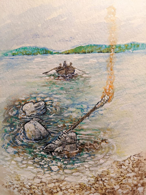
Illustration of a Pilgrims Pathway ferry crossing from Peach Bottom, York County, to Peter’s Creek in Lancaster County by Peggy Eppig
It is estimated that thousands of freedom seekers chose to cross the Susquehanna as soon as possible once they passed the Mason-Dixon Line. Guided by abolitionists called conductors and station masters working along this route in York County, much of it following the Susquehanna and Tidewater Canal, people crossed the river to Lancaster County landings. Freedom seekers traveled the steep wagon roads up and out of this difficult terrain of rock ravines and deep valleys to follow creek roads east towards Christiana or north to Columbia and Lancaster.
This system of roads, towpaths, river crossings, and safe houses (barns, mills, businesses, and homes) became known as the Pilgrims Pathway, the name given to this dangerous segment of the Underground Railroad in the Susquehanna Riverlands region. You can still find place names, roads, and even a public golf course that maintain ties to this named route.
In York County, visitors to McCalls Ferry Nature Preserve, Mill Creek Falls Nature Preserve, Robert A. Kinsely Nature Preserve, and Otter Creek Nature Preserve can explore these landscapes that once served as vital river crossings. Trail systems incorporate paths and old roads that navigated dangerous terrain down from the plateau to the river, such as those at Mill Creek Falls Nature Preserve, which is close to the site where Margaret Morgan and her entire family were kidnapped on their farm by slave catchers in 1837.
On the Lancaster County side of the Susquehanna, ferry landings, wagon roads, and farm paths are a part of trail systems incorporated into Ferncliff Wildlife and Wildflower Preserve, Kellys Run Nature Preserve, Fishing Creek Nature Preserve, and Shenks Ferry Wildflower Preserve. Hiking in any of these preserves will utilize trails that were part of the Pilgrims Pathway Underground Railroad route. When Lancaster Conservancy protects our natural landscape, we protect more than our forests, streams, and wetlands – we also protect the histories of these landscapes and the people who were here before us.
